 To drive along the coast of Peru is to journey through numerous cultures spanning more than 6,000 years, charting the rise and fall of civilazations. As we travelled north up the coast in February 2016, we visited as many archaeological sites as we could to try and get an understanding of the pre-Columbian history of this fascinating country, as well as taking some time to appreciate the rich coastal sea-life.
Bruce here…

The Oasis of Huacachina near Ica in the south of Peru
The coast of Peru is in reality a vast desert but it is interrupted by river valleys that drain out of the Andes into the Pacific Ocean. It is these valleys providing a source of water that form oases, which allowed villages, towns and, finally, large-scale cultures to develop. The ready supply of water, along with innovative irrigation techniques, provided the means for growing the crops that had been domesticated in this part of the world. These crops, along with abundant fisheries off the coast (rich as a result of the cold Humboldt current), meant that there could be an excess of food produced, and so large, structured populations that included non-farmers (such as artisans, priests and rulers) could be supported. So large in fact that many of the cultures managed to construct monumental buildings, many of which are still around as ruins today.
As geography and history seldom coincide linearly, this blog will travel through the cultures in a roughly historical order rather than the order that we encountered things – we thought it would be interesting to try and disentangle what we had seen for ourselves. Geographically, you can split the country roughly north-south along the coast, with Lima in the middle, and then also the inland, highland cultures, which culminated in the Incan Empire. There were a number of concurrent cultures and I have tried to surmise the ones we encountered both in a timeline of the cultures and a map of the archaeological sites:
The timeline and map can be opened in a separate window.
 Our journey through the human history of Peru really started with the Cuevas de Sumbay and Mollepunku near Arequipa, which date back to before civilisation. The Cuevas de Sumbay was the most ancient archaeological site we came across in Peru and consists of a set of ~8,000 year old prehistoric cave paintings. They were a bit of an adventure to get to, but were well worth the trip. The caves were used by ancient nomadic hunter-gatherer tribes in the area and the paintings are suggestive of rich hinting grounds. The paintings in the Cuevas de Mollepunku are younger, probably around 6,000 years old. Again they are pre-historic and quite fun to reach.
3500BC: Caral – a cradle of civilisation
We were excited to visit Caral, just north of Lima, because the Caral culture is the oldest fully-fledged culture that we came across. It is now recognised to be one of seven places around the globe that civilisation is considered to have emerged and is the oldest known civilisation in the Americas. The main site itself includes about 20 temple complexes, each one in the form of an adobe pyramid. It is so old (about 5,500 years) that they were actually pre-ceramic, which can make things a bit difficult to date, but they were building huge adobe pyramids here 500 years before the Great Pyramid in Giza! The dates come from some wooden artifacts that have been preserved by the dry desert atmosphere. Caral was only discovered to be an historic site in the 1990s and its age and significance was only revealed just over a decade ago. Before then, these pyramids were unrecognised hills hidden under sand and soil, which leaves you wondering what else remains to be discovered under other desert hills…
Travelling north from Caral:
3000BC: Casma/Sechin
This is the second oldest major culture in Peru, although there is even the suggestion that one of the artefacts might be as old as (or older than) Caral and date back 6,000 years. The site we saw was the temple at Sechin, which is quite gruesome with many depictions of body parts and heads with blood flowing out of them. There are several theories surrounding what they depict, including sacrificial offerings from within the Casma elite, sacrificial offerings of conquered warriors or just simply anatomy lessons!
Now things start to get a bit more complicated as there were parallel cultures in the north and south. These then either evolved into something different, or were absorbed by another culture all together!
800BC: Paracas (south coast)/Chavin (north coast)
About 3,000 years ago a couple of cultures came to prominence (in that they left a number of archaeological sites): the Chavin in the north and Paracas in the south.

The Candelabra of Paracas
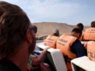
There are not many archaeological sites and pottery findings that have been found of the Paracas. The main sites are some tombs, which contained some amazingly preserved and delicately produced complex patterned fabrics, and this Candelabra geoglyph. The Candelabra can best be seen from the sea and is usually included on a boat trip out to the Islas Ballestas, from the town of Paracas. The Islas are visited to see the huge numbers of birds that nest there, supported by the unusually nutrient rich seas along Peru’s coast, thanks to the cold upwelling of the Humboldt current (which makes much of the coast rather cold for swimming, despite the tropical location).
Around the same time that the Paracas were living in the south, the Chavin appeared in the north of Peru, around Huaraz and the Corderilla Blanca (see a future blog) but had an influence that extended along the coast. They lasted for a similar period of time and then were subsequently superseded by the Moche.
We popped out onto the Peruvian coast after our detour to Ayacucho for Carnaval near Paracas on 8th February 2016, then drove south to Nazca before heading north all the way up the coast:
100BC: The Nazca

Stylised map of the Nazca lines
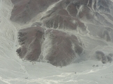
The Nazca, who are well known for their geoglyphs, which are even more monumental than the Paracas Candelabra, may have succeeded the Paracas peoples about 2,000 years ago, before what is believed to be a series of bad El Niños that finished them off. There has been some evidence unearthed that the Nazca may have practiced human sacrifice, probably of their own high-ranking subjects, to appease their gods in times of need.
The meanings of the monumental geoglyphs are still disputed, with a number of ideas promoted, from astral calendars and indicators of underground water, to religious artwork for the gods or something created by aliens! In reality there may well be a bit of truth in most of the ideas, with one obvious exception.
The lines and geoglyphs, which are spread over a huge area of desert, are best seen from the air and everyday lots of small planes take off from the local airport and fly in tight circles round some of the geoglyphs. We would recommend that you take travel sickness pills as we are sure the pilots compete to see who can make the most passengers ill (I was one of the victims that day)!
As well as the Nazca lines, there are a number of other Nazca archaeological sites, including the heavily restored religious centre of Cahuachi, just south of the lines.
100AD: Moche/Lima
Around about 100AD, the Moche culture developed in the north of Peru, initially in the Moche Valley, and then spread across a number of the neighbouring valleys. Meanwhile, in the central coastal region, the Lima culture flourished. A large pyramid complex is still standing (Huaca Pucllana) in the middle of Lima today.
The Moche culture is well known to archaeologists and two of the best examples of their monumental architecture are the giant religious pyramid temples of Huaca del Luna and Huaca del Sol just outside of Trujillo. These face each other and had a city sat between them. Both pyramids are believed to have been rebuilt on top of the previous one periodically, probably after periods with particularly bad El Niño events. This is what makes them so large. The same practice is also why the Huaca Pucllana in Lima is so big. Excavations of the Huaca del Luna have revealed areas of wall that still have the original paintwork, beautifully preserved by the building of the next generation of temple on top.
Another important Moche site is the pyramidal tombs of Sipán. This was one of the few sites undisturbed by tomb robbers and is the Peruvian equivalent to the Tutankhamun discoveries in Egypt. The museums associated with Sipán display the contents of the tombs and are well worth visiting before seeing the site itself. One of the tombs contained the “Señor de Sipán”, along with several wives, a general, a guard (whose feet had been chopped off), a child, a couple of llamas and lots of material artefacts. Researchers learnt a lot about Moche life from these tombs.
They also practiced human sacrifice but again there is contention as to whether the sacrifices were Moche nobles who lost ritual fights or were conquered warriors from other groups. Climate change probably did for them the same time as it troubled the Nazca (and the Tiwanaku in Bolivia), around 800AD.
900AD: The Chimú
The Moche were followed fairly seamlessly by the Lambayequi in a small region in the north around Túcume (which we hope to visit soon) and subsequently the Chimú around 900AD. The Chimú are famous for a collection of ruins at the mouth of the Moche Valley, also in and around Trujillo. This site is Chan Chan, which is a collection of 10 walled ciudadelas (ceremonial sites and home of the king), each one built by an individual Chimú king. When a ruler died, he was buried there and the next king started again with a new ciudadela. The next king was not necessarily the oldest son – the most able of the sons was generally chosen.
Around the same time, the Lima culture were probably absorbed by the highland Huari, who came from near Ayacucho and had an extensive influence south past Cusco and also west to include much of the coast of Peru. We didn’t see the main Huari ruins near Ayacucho but came across their burial sites in the Colca canyon and some artwork at the Petroglyfos de Toro Muerte, near Arequipa.
900AD: The Chincha
Meanwhile, back in the south, the Nazca may have been followed by the Chincha about 1,000 years ago and the seldom visited ruin of Chichacamac was an important site, again with an adobe pyramid.
Of course, travelling up Peru’s southern coast, through fertile valley after fertile valley, we couldn’t drive through South America’s oldest wine regions without stopping! The Tacama vineyard was planted by the Catholic church to be a source of communion wine and is the oldest in South America. But, in Peru, grapes really are all about the Pisco.
1200AD: The Inca
And then there were the Inca, who created their enormous empire from Quito in Ecuador to the north all the way down to Santiago in Chile to the south…
On 29th February we reached the westernmost tip of South America and rounded it onto Peru’s far north coast, where the waters are warmer and the coast is dotted with beach resorts:


Pingback: Lima: a six day foodie splurge | Yellow Van Days