
 With Santiago as our base, we were fortunate enough to have the opportunity to travel to both the seldom visited Robinson Crusoe Island, to do some research fieldwork, and the more famous Easter Island (Rapa Nui), as tourists….
Robinson Crusoe Island
Bruce here…
Robinson Crusoe Island, part of the San Fernandez Archipelago, was the first of the two off shore Chilean islands we were lucky enough to visit. The trip was actually as part of some research fieldwork, which had been arranged before we left Oxford. It was based on my previous project in Oxford, which took 3D photographs of volunteers’ faces, with the aim of finding genes behind facial features.
 The project had previously collaborated with Dianne Newbury (also from Oxford), who is working on the genetics of Specific Language Impairment (SLI). Her collaborator, Pia Villaneuva (the University of Chile), works with the people on Robinson Crusoe Island because the incidence of SLI there is very high (~30% compared to ~5% in most places). The history of the island means that there are high levels of relatedness amongst the inhabitants and this could be very helpful when looking for genetic associations in, for example SLI or facial features. Dianne and Pia had suggested a collaboration to take some 3D photos a year or so before I left Oxford, which, as it turned out, fitted in rather well with our plans.

We were the only passengers on the flight out
And so, after great deal of work from Dianne getting a camera out to Santiago, and Pia finding her way round Chilean customs to retrieve the camera, we made it to the island in late April. You can get there either by boat (the most reliable way if the weather is rough) or via a small charter plane (which won’t fly if the weather is bad) and we flew out with Pia and three of her colleagues (Lía, Cynthia and Angelica). As the plane is so small, and we had a lot of equipment with us, everything had to be weighed (including ourselves)!
Landing on the island is interesting. The airstrip is quite a difficult one to land on as there is just enough space for it across the end of the island, with 100m drops at either end into the rocks below. Indeed, a well known Chilean TV personality and an entrepreneur were both killed when a plane crashed on landing a few years ago. We didn’t know this until after we had left the island… Once on the island, there is then a one and a half hour boat journey around the island from the airstrip to the town, embarking from the midst of a fur seal colony.

View of Robinson Crusoe Island from the plane
The work itself went well, putting in long hours to try and catch parents as they dropped their children off at school in the morning, picked them up in the evening and came back for evening meetings etc. This left little time to explore at first but by the end of the week, we did have a chance to see the town, do a bit of diving (huge numbers of fish and lots of octopi), a small bit of walking and lots and lots of eating of fish, crab, octopus and a lobster. This is definitely somewhere you come for the seafood, as there are only one or two ships a month that arrive to bring everything else the islanders need, whereas the seafood is right there.

Taking 3D photos was harder when we had to do it all in Spanish!
We also had time to get to know some of the history of the island and even met a real life treasure hunter from Chicago! The island itself has an interesting history as it was first discovered and placed on the map by San Fernandez in 1574. It had no history of inhabitation and the first person to stay there for any length of time was Alexander Selkirk, a Scottish sailor who in 1704 decided that the privateer he was on was dangerous. He asked to be put off at the next island (known as Más a Tierra then), which the captain readily agreed to. Despite changing his mind, he was left there and lived there alone for four years and four months, before being picked up by a British ship. On returning to Britain, his story became the inspiration of Daniel Defoe’s Robinson Crusoe. However, there are some key differences.
The island is part of a chain formed by volcanic action, just like Hawaii. This means that the island is quite hilly, with very steep walls into the ocean for the most part and so golden sandy beaches just don’t exist. Defoe set Robinson Crusoe in the Caribbean, which is why the story is associated with a sandy paradise. Also, the island really was uninhabited, so there could not be a Man Friday! Incidentally, Alexander Selkirk was correct and the ship he had been on did sink off the coast of Columbia and the survivors had to face a Spanish goal.
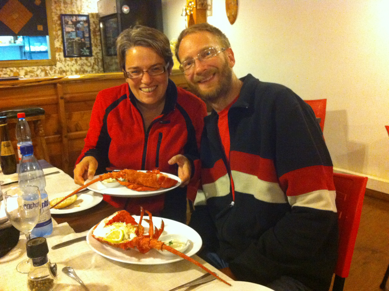
We ate more crab and lobster that week than we would probably normally get in a year!
After a brief period as a penal colony in the 1830s, the island was subsequently settled by a few families in the late 19th Century and there is some debate as to the ancestry of those families. The island has been continuously inhabited since then, with the main population in the town of San Jaun Bautista, and some seasonal living on Alejandro Selkirk Island (formerly Más Afuera), some 180km away. The population has always been small and is currently around 800 and their main source of income is from fishing the local spiny lobsters (which have the main characteristic of not having claws). The Chilean Government renamed the island to Robinson Crusoe Island in 1966 in a bid to attract more tourists and indeed there is now some tourist income, particularly during the Chilean holiday periods.
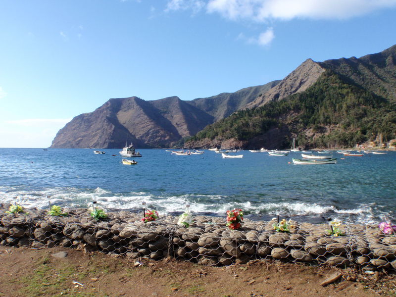
An elegant memorial to those who were klled in the tsunami, flowers for each victim along the front of the bay
In 2010, they were badly affected by a tsunami, which followed the massive earthquake just off Valparaiso. It devastated the town and the damage is plain to see, as the local businesses are still in the process of rebuilding. Sixteen of the islanders were killed (a large proportion of a tiny population) because there was a misunderstanding between the organisations involved in the warning systems that meant they weren’t warned at all. Many more people might have been killed but for the actions of a 12 year old girl who saw the water receding, realised what was happening and sounded the warning bell on the shorefront. This is an event that is still talked about in much detail by the islanders and is one of those once in a generation catastrophes, along the lines of the 1935 and 2015 earthquakes that have hit Nepal.
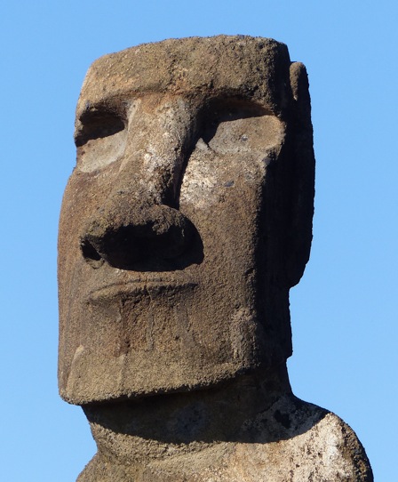
Here are some pictures of Robinson Crusoe Island. Scroll down to read about Easter Island.


Easter Island (Rapa Nui)
Rebecca taking up the story…
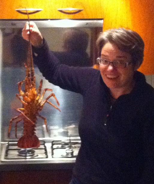
With our live lobster from Robinson Crusoe back in our rented apartment in the centre of Santiago
After a week back in Santiago, enjoying a spell of city living (as well as cooking and eating the live lobster we had unexpectedly come back from Robinson Crusoe with – we had ordered a prepared frozen one, but there were none available when it came to it and we all found ourselves on the plane with live ones!), we were back on the plane out of Santiago again, this time a large passenger jet, for the 5 hour flight to Easter Island.
Easter Island is the most remote inhabited place on the planet (>2,000 miles from Chile, the nearest continental land) and a complete contrast to Robinson Crusoe Island. Although formed by similar volcanic processes and consisting of three dormant volcanic cones, it is surprisingly low level, and, of course, famously, the only trees are those recently planted as part of reforestation efforts. We found our visit to be an unexpectedly melancholy experience, a schizophrenic mix of exotic island holiday and challenging history lesson. It’s a would-be, once-was, but not-quite now island paradise that is still in the early stages of recovering from its terrible history.

A restored “Ahi” with the “Moai” heads remounted
It was the more recent history that caught us by surprise. We went expecting to learn about an historic people who over-exploited their island, leading to a deterioration of a highly structured, rich society into war and disaster. So far, so what all the BBC documentaries tell you… But what we hadn’t necessarily appreciated was how recently that all happened and how the awful story has continued since then. Indeed, the current political situation is far from settled and it is clear there is still a lot to be resolved on the island.

A Moai that was never used lies near the quarry where they were carved
The period of internal war, which was when the islanders toppled the famous head statues, probably as tit-for-tat actions between warring tribes, was ongoing when Europeans first arrived. Despite it’s remoteness, there was actually little surprise to see these “big” ships arrive and the noted interest in measuring them may link back to the strong oral history amongst the people that retells the arrival of the original founders down to the detail of the large size of boat that they travelled in. This was a previously expert sea-faring people who, despite not having the materials to build boats any longer, had a strong cultural heritage and memory of sea travel.
When Europeans first arrived in 1722, the island’s population was down to around 2,000 – 3,000 from an estimated peak of 12,000, but by 1877 only 111 inhabitants remained. In the 1860s, Peruvian slave traders had kidnapped about 1,500 people, half of the remaining population, into mining slavery. Included in that number were all the people that knew the island’s “rongorongo” writing script, the only script known to date in Polynesia and, as of yet, not deciphered.

The two of us in front of the “Ahi” gives an idea of scale!
Under pressure from other nations, the Peruvians were forced to repatriate the surviving islanders, but, by the time they did, it was a pitiful party of only 15 people who were returned to the island. It was this returning party that dubbed the island “Rapa Nui”, meaning “Big Rapa”, referring to another, smaller but similar shaped, Polynesian island, and the name has been adopted by the Rapa Nuians as the islands modern name. Unfortunately, this little group brought small pox back to the island with them, which decimated the small remaining population.
At this stage, almost all the island, save a small area where missionaries had based themselves, was “bought” by a French mariner and turned into a sheep ranch. The missionaries evacuated some of the remaining population. In the end, only 111 Rapa Nuians survived on the island and, having lost 97% of the population in a decade, most of the cultural knowledge was also lost.
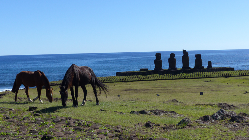
The island is now home to a large population of wild horses
The island was then annexed by Chile in 1888 and the tiny remaining population was effectively enslaved on the island, confined, behind barbed wire fences, to the small area not occupied by sheep, not allowed to move around or leave the island. To our shock, this was the way things remained until 1966, when the population was finally given Chilean citizenship. Most of the island is now a national park managed by the Chilean national parks authority.
Today, the population is about half Rapa Nuian and half Chilean immigrants, many of whom are attracted by the tax-free status (unofficial reparations for the Rapa Nuians perhaps?) and the tourism industry. And there are tensions… In recent years, Rapa Nuians have started to seek more control and say in how their island is run (from Chile). In 2011, a UN report expressed concern about the treatment of the indigenous people’s by the Chilean government.

The Rapa Nui flag flies over the entrance to one of the sites
In March this year, the Rapa Nui “parliament” (an unofficial body of local people who would be the island’s government) took over the national park, putting up road-blocks and controlling entry. This was still the situation when we arrived in mid-May. The Rapa Nuians allow tourists to enter (although no entrance fee is being collected) along with guides who are Rapa Nuians, but no Chilean or other foreign guides are allowed in, effectively limiting the immigrant Chileans to the area of the main town, the only park of the island that is not national park.
Our guide Chris explaining the rituals of the more recent Birdman cult to Bruce
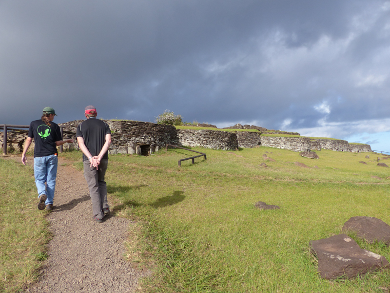
We hired a guide to take us around to see the numerous sights retelling the history, which proved to be money very well spent. Our guide, Chris, is American by birth, but has been living and working on the island for nearly 20 years and, with his Rapa Nuian partner, has teenage Rapa Nuian children, so is now considered to be islander by the “parliamentarians”. As well has having incredible in-depth knowledge of the history, including the tribal oral history (his partner tracing her heritage back to one of the original tribes), he was able to give us fascinating insight into the current politics.
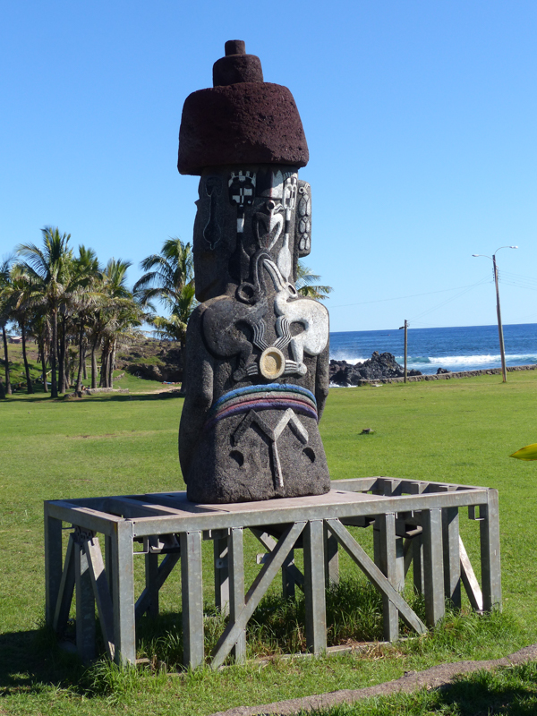
A recently machine carved and decorated Moai that has travelled the world, promoting the Rapa Nui culture
Some of the locals are looking for full independence, but many recognise that the island is probably not self-sufficient (unless there was a big investment and boost in tourism, which many of the islanders do not want to see) and so would benefit from remaining part of Chile, just with more local autonomy. The ongoing protest seeks more local control of how the national park, containing what the Rapa Nuians consider to be sacred monuments, is managed and controls to limit immigration from Chile.
When we returned from the island, we learned that, while we had been there, the decision was made in Canberra (Australia) to annex another pacific island, Norfolk Island, and bring it fully into the Australian governance system (interesting article here). Norfolk had, until now, been run by a local parliament, but the island’s population is too small to be self-sufficient and, for this reason, it is being made park of Australia in order to provide better access to modern social, health and welfare systems. As Easter Islanders are fighting for more independence and autonomy and Norfolk Islanders are loosing theirs. Interesting times…
Meanwhile, our guide, Chris, will be presenting his own new theories as to how the statue heads were transported around the island from where they were carved to where they stood on the burial mounds – one of the island’s great unanswered questions – at the 9th International Conference on Easter Island in Berlin, Germany, in a couple of weeks time. He’s keeping his theories completely hush-hush until then, but has promised to send us a copy of his presentation when it goes live. It will be his first time at a conference, let alone presenting controversial (they are bound to be!) new ideas to seasoned audience. Break a leg Chris!
Some more pictures from Easter Island (Rapa Nui):


Pingback: Cities, wines and climbs: Santiago to Mendoza | Yellow Van Days