
 This amazing drive, the first half of our first crossing of Bolivia, started with the “Lagunas Ruta”, in the remote southwest corner of the country, and took us across one of the wonders of the world, the Salar de Uyuni – and not without incident! As we left Chile, we were braced for one of the most remote and challenging drives of the trip…
Becca here…
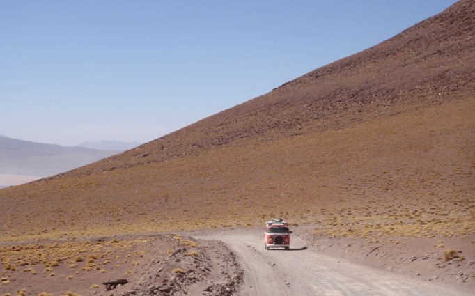
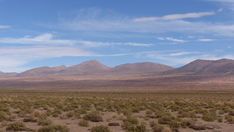
The Lagunas Ruta (Lakes Route) connects a series of lakes heading north through the remote and uninhabited high Andes Altiplano from a border crossing into Bolivia that is just 50km from San Pedro de Atacama, but nearly 2,000m higher in altitude. Finally, on 11 August, after our extended stay in the Atacama region, we were on the road again, climbing steeply up onto the Altiplano between the volcano peaks.

The Lagunas Ruta follows a high altitude route between lakes and volcanos in the Altiplano
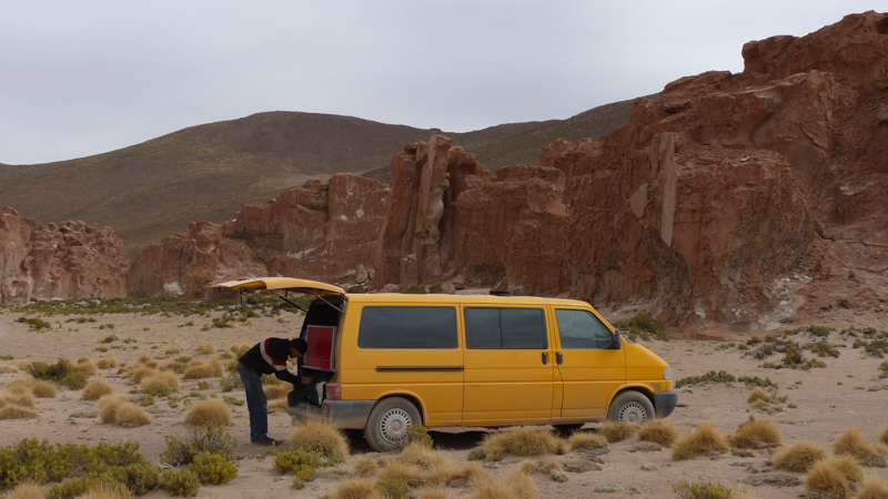
As we turned off the main road onto the track to the Bolivian border, we were feeling a little concerned by how much the van seemed to have struggled with the initial climb and then completely thrown when it failed to get up a little bump in the track. We needed to roll back down and take a good run up in order to make it to the top! This was not a good start!! And disappointing given how well the van had performed at the geysers in Chile, which were also up at well over 4,000m. We stopped at the top of the hillock and considered our options… perhaps our little European engine wasn’t strong enough for this trip through the Altiplano after all?
We hadn’t been stopped long before a minibus on the way to the border to collect backpackers pulled up to see if we were alright and, through an English speaking guide, the driver proceeded to reassure us that the van would be perfectly up to the job, we just had to adjust to driving at altitude. Firstly, he had us turn everything off and flick the ignition 3 times, apparently to reset the sensors, which sometimes go haywire in the thin air – effectively a reboot. Already the engine sounded happier when we restarted – perhaps the very steep sharp climb had been a little confusing for the sensors. Then he told us to always keep the revs above 2,000rpm. We set off for the border much reassured and now driving to maintain momentum and power, despite the difficult unfinished road conditions. Immediately we were rewarded by the stunning scenery of the harsh altiplano.
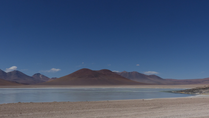
The first of a series of lakes, Laguna Verde
We expected the road to be rough, but also remote and deserted, so we were in for a bit of surprise when we began to notice quite how many Landcruisers there were hurtling up and down it. It turns out that this route is now on the “backpacker trail” and people pile into Landcruisers further north in Bolivia to be taken down through to the Chilean border where minibuses meet them to take them to San Pedro. There are hundreds of Landcruisers doing this trip – as it turned out, we were never alone for long! Parked at Laguna Chalvin, the Yellow Van was surrounded by a constantly turning over collection of Landcruisers waiting while their backpacker passengers took a welcome warming dip in the thermal pool (which we also enjoyed in a rare quieter moment).
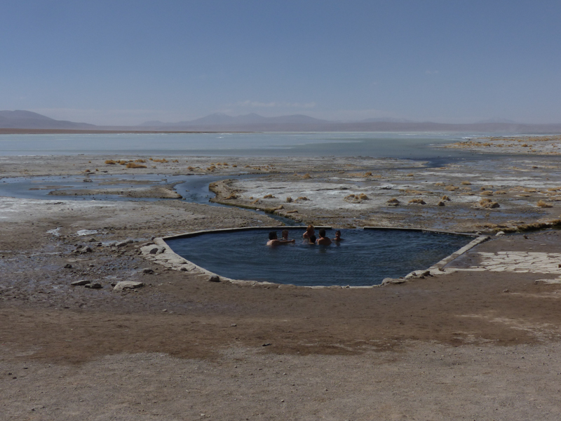
Laguna Chalvin has a refugio and thermal pool – our spot for the first night

Our highest altitude yet – 5,074m
The next day, we took a detour to find the Bolivian customs office, located at a mine 80km from the border, to complete the temporary import paperwork for the van. This took us to the highest point yet, over 5,000m, passing the geysers and mud pools of Sol de Manaña on route.
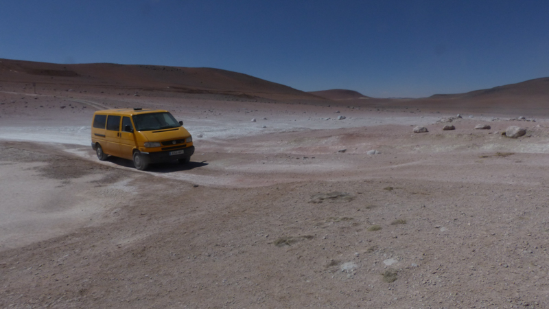
Driving through the Sol de Manaña
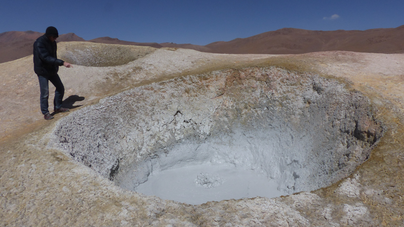
Mud pools at Sol de Manaña
Lovely to see something other than a Landcruiser!
Driving on to Laguna Colorado, we were delighted to spot another VW van, a classic bus, toughing it out coming the other way. We both stopped as we passed, excitedly wound down windows, despite the dust, to exchange cards (for website details etc.) and a few words of greeting, making the Landcruisers wait behind us.

Approaching Laguna Colorado

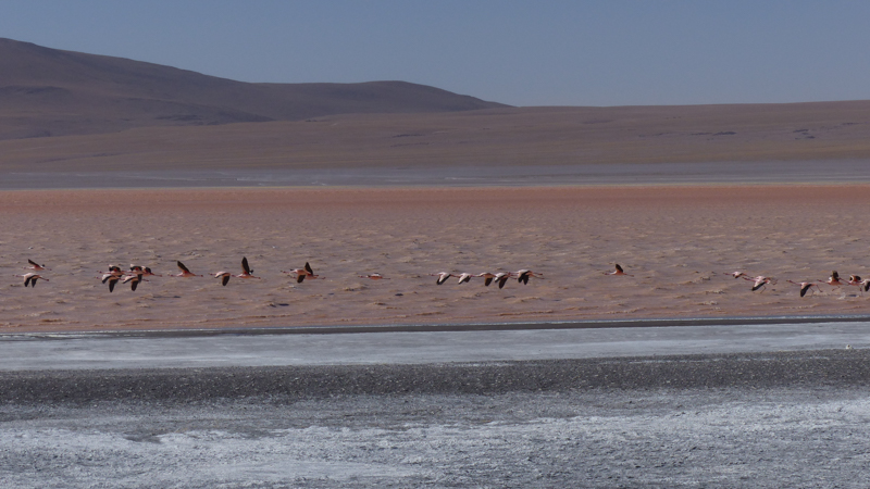
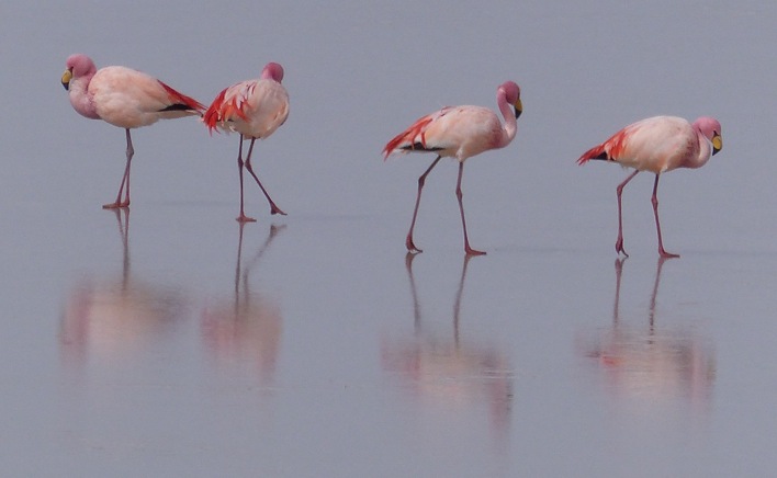
Complete with a group of very pink James’s Flamingos
The water containers out in the sun to defrost!
The next night was our coldest yet. We were getting used to getting under our sleeping bags and blankets in the early evening to keep warm until morning, with everything we needed to make breakfast ready in the van with us, then waiting in the morning until the sun was up to start to warm us up again. This night, camped in this little corner by the road at 4,500m, the temperature in the van when we woke up at 8.30am was -10C, so goodness knows how cold it had been down to! All the water in the jerry cans etc. was frozen solid and we had a long wait on an overcast morning for things to warm up again.
Laguna Capina – more of a salt flat than a lake
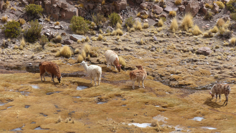
Llamas feeding in a frozen valley
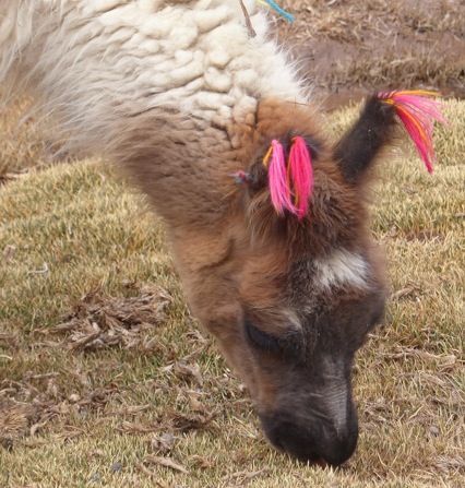
I like to wear pretty earrings…
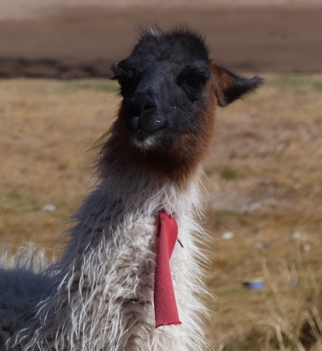
…whereas I prefer a tie.

This little dog apparently owns this bit of road, in the middle of nowhere!
That afternoon, we drove through the Valley of Rocks and, overcast, cold and high up as it was, Bruce got his climbing boots out.
My climbing boots are in here somewhere!


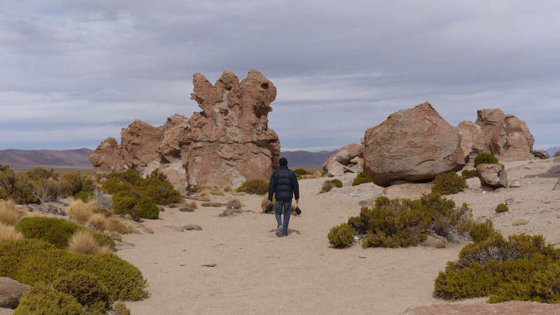
More rocks to enjoy further up the valley

The beautiful bird life continued at little Laguna Vinto.


Leaving the backpacker trail behind, we cut directly north towards the Salar de Uyuni from Alota to San Juan.

This small road was in the process of being improved, but we caught up with the roadworks. A sign at the start of the road had indicated the road would be closed until 6pm. Fortunately, we arrived just about at 6pm, but finding it still most definitely blocked, had a conversation that went along these lines: “When will the road be open?”, “At 6pm. What time is it now?”, “6pm”, “Oh….”. It didn’t look to us like it would be reopening anytime soon, but, amazingly, the digger had the road cleared and flattened to drive over within about 3/4 hour!

Surely it’s going to be awhile before we can drive down here…
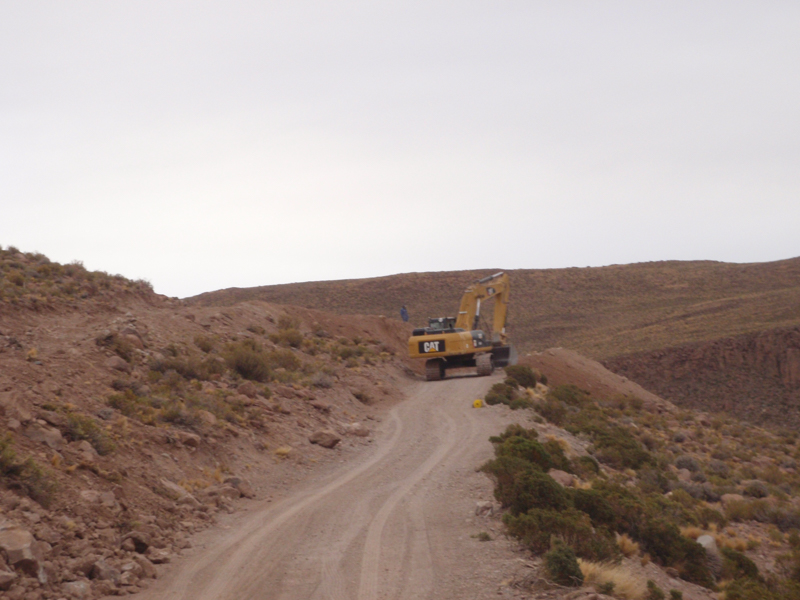
Amazingly, it was cleared just a short time later

A couple of families going to the next village joined us waiting – an opportunity to practice our Spanish
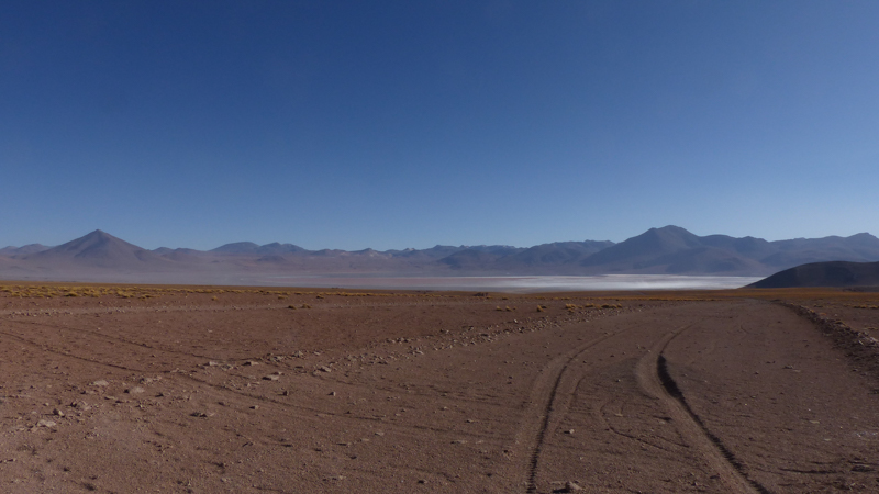
Along some sections of our route, we were glad of the reassuring blue dot of the GPS on our mapping app confirming we were going the right way!

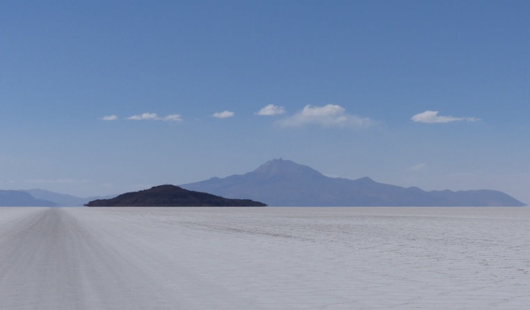
And finally, after 3 1/2 days driving, we were approaching the Salar de Uyuni…

… which is crossed by normal buses!

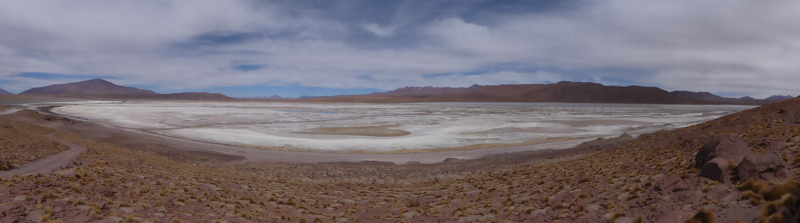
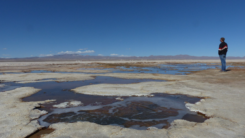
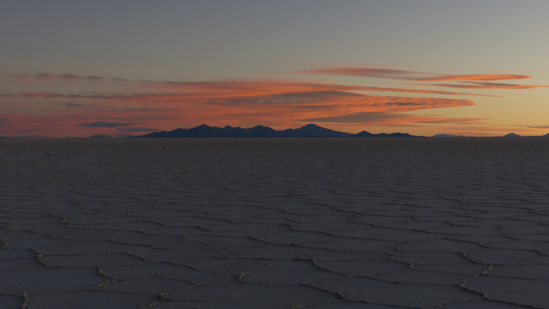
The Salar de Uyuni is 10,582 square kms of salt flat, sitting at 3,600m. And when it says flat, it really is flat. It floods with a thin layer of water each year and dries out leaving an absolutely flat, white surface as far as the eye can see, punctuated by a few small islands of ancient coral rock and cacti.
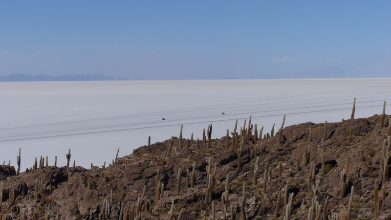
Coral islands in the Salar

Pleased to have made it to the Salar

Surrounded by those Landcruisers again, visiting the Isla de Pescado
Planning to stay the night on the Salar, we drove on another 20km to another island and tried to find a spot out of the harsh wind that was blowing that night. To get shelter from the wind, we needed to get close to the island, so we decided to follow some tracks heading towards the island edge. We knew the surface can get soft near the edges, but we were reassured by the track marks we were following… how naive… suddenly, the surface cracked and, just like driving into a hidden puddle, the front of the van was sunk deep into the mud below…

For the last hour or so of daylight, we started the process of digging ourselves out… We got out the high-lift jack (which we hoped we would never need!), which itself needed rocks from the nearby island putting under to give it a foundation in the mud, and raised each side in turn, piling rocks under the wheels to raise the van up out of the mud…

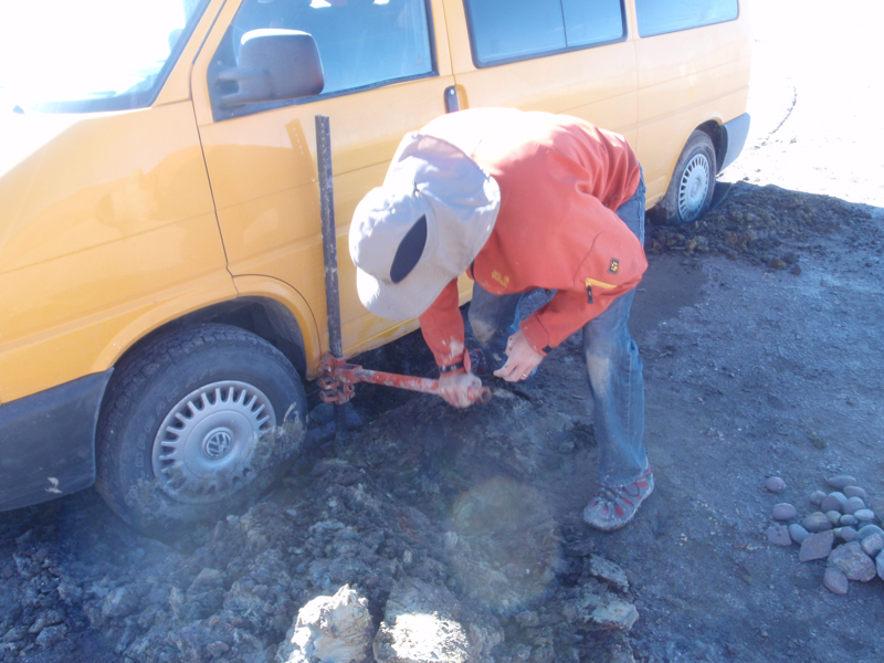


By lunchtime the next morning, we had done that several times each side, as well as tried to dig away underneath were it was beached.


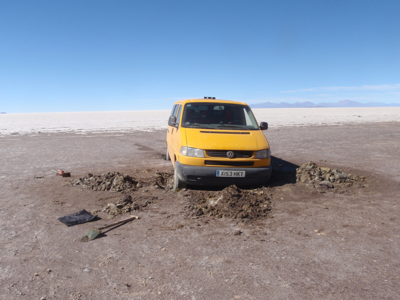
But with three wheels spinning (the differential lock just locks the back axle) and the front beached, it was going to take days and days of excavating and road building to get us free under our own steam… By then we had also wandered around and found 5 scars from previous places vehicles had driven near the island and got stuck! We made good use of the rocks and plant material they had used to put under their wheels…


A little higher out of the mud… perhaps?
So we decided to be sensible, swallow our pride, and get out the satellite phone to call for assistance. A few confused phone calls in bad Spanish later and an English speaking tour guide arranged for one of those big Landcruisers to come and rescue us – at a price!
Waiting to be rescued!

His towing cable and ours together just reached from the edge of the solid ground – phew!

Pleased to be out!

We left our large scar to join the others in the area – let them be a warning to others!
After a thorough wash of the van and the rescue kit…

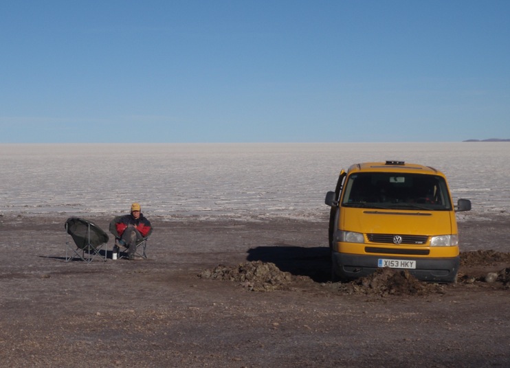
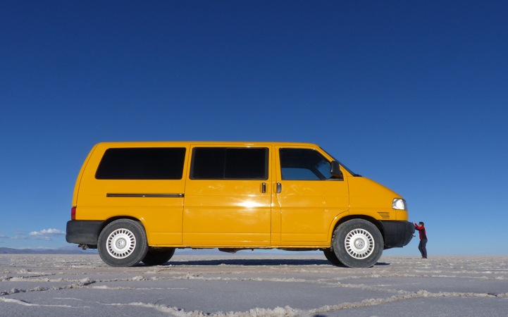
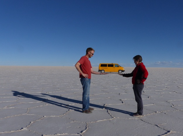
And a few days recuperation in Uyuni, we returned to the Salar for a more relaxed, wind-free overnight stay and the obligatory silly photo shoot…


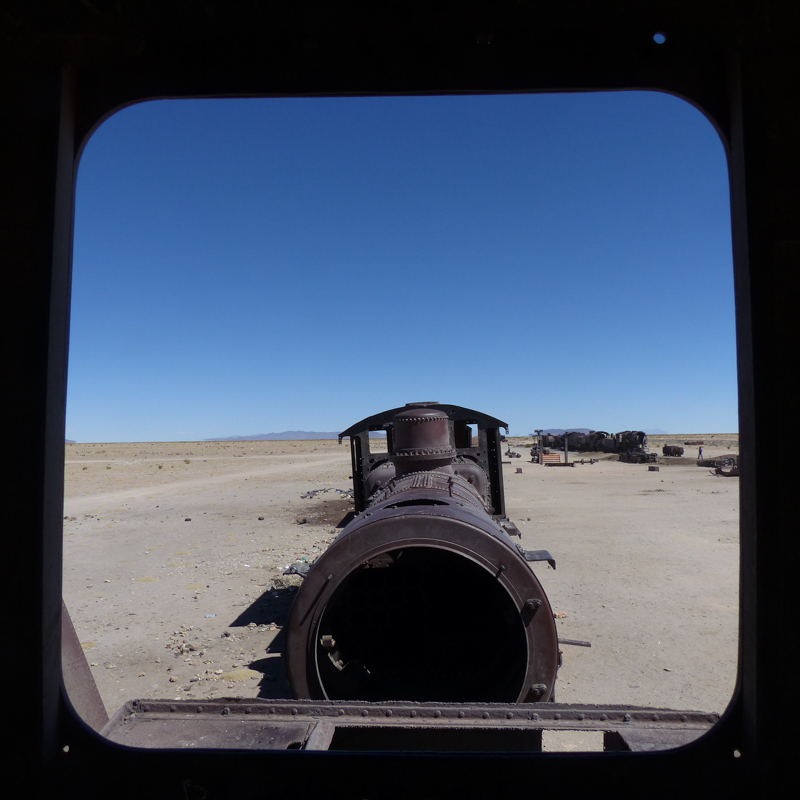
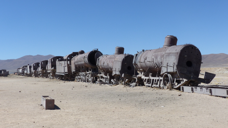
Just outside of Uyuni is a “train graveyard”. The railway line serving the mines further north, taking the mine output down to the port on the coast at Antofagasta, was built by the British at the end of the 19th century. In the 1940s, during a downturn in the mining industry, a number of trains were abandoned near Uyuni and left to the elements. It now makes for an interesting spectacle in the desert.


After an action packed 9 days, we set out onwards, northeast across Bolivia towards Brazil.


Quite a trip and glad you made it out of that mud. Reminds of once when we got stuck in sand in Baja California on that was rather less remote!
Your blogs are always very interesting- You will have a book already by the time you are finished.
Best wishes Walter
LikeLiked by 1 person
It’s certainly a story for the pub and justified us having the high-lift jack (borrowed form a friend) and a satellite phone! It wasn’t really that remote as there was a coral island 20km away that all the tourists visit and so has many, many Toyota Land Cruisers there. We preferred the idea of ringing for a tow rather than spend 5-6 hours walking in the heat to get help but that was always an option…
LikeLike
Love the inspired “silly” images some of the best Altiplano pics we’ve seen! Am still keeping in touch with Red Burrito couple, Manuel & Gill, hope to see them in Worcester before we head off next year – did you have a look at his website: http://www.chasingthemorningsun.com – we’re still trying to figure out pros & cons between buying either a tricked up well looked after LHD VW T5 4motion petrol camper van from Germany and ship it over to Halifax Nova Scotia starting there -v- Toyota Tacoma 4×4 pick-up pop-up combo sourced in USA which looks capable but Manuel mentioned he’d seen a few pick-ups down the Pan Am where the chassis had bust due to the shifting weight of the pop-up out back so he recommends van solution as being best to live in/with day to day on the road. What do you think? As they say in Zululand “humba gashli wena!”
LikeLike
Hi Digby & Martine, glad you enjoyed the blog. Shows a good old VW can get anywhere (albeit with a good old simple & robust diesel engine, 4wd and souped up suspension!) I’ve dropped you an email with a suggestion of someone to contact with more experience with the Toyota pick-up camper combos than we have. Hope you find it helpful, Rebecca
LikeLike
Love the photos, especially the forced perspective ones.
LikeLiked by 1 person
Thanks Ingrid – it was fun to do, although a little challenging without a third person behind the lens when both of us werein the picture! We had to rely on muscle memory!
LikeLike
Pingback: Bolivian Highlife: In and out of La Paz | Yellow Van Days
Pingback: Climbing in Chile and Bolivia: Places with potential | Yellow Van Days